Special guest editorial by Tim Holt-Wilson
UK planning policies give some protection to geodiversity outside the network of designated sites and areas. In England, Planning Policy Statement 9: Biodiversity and Geological Conservation (PPS9)[1] views the delivery of geoconservation as one of the objectives for sustainable development, nature conservation and social renewal, and lends important support for local efforts to conserve geo-sites and features. Local planning authority policies should attach ‘appropriate weight’ to designated sites and also (significantly) ‘geological interests in the wider environment’. Local authority plans and policies should be based on up-to-date information about the environmental characteristics of the areas, including geodiversity. The aim of planning decisions should be to prevent harm to geological conservation interests, and PPS9 establishes the principle that where harm is unavoidable adequate mitigation measures should be put in place; Section 106 agreements can be used to deliver such benefits for geodiversity. Green Infrastructure initiatives provide opportunities for bringing geodiversity objectives into the design of new development alongside biodiversity, for example enhancing access and providing interpretation. Planning policy on geodiversity in Scotland is weaker than in England, and is considered as an unstated component of ‘Landscape and Natural Heritage’[2].
Landscape
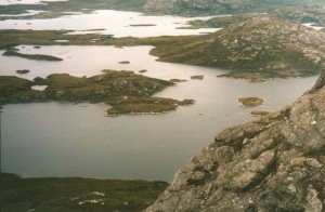
Geodiversity contributes the fundamental elements of landscape directly through geology, geomorphology and soil type, and it thereby influences habitat, patterns of settlement and land use. The foundations for landscape conservation were laid in the 1990s through the Natural Areas and Countryside Character Areas concepts (now replaced by National Character Areas). At a more local scale, landscapes may be mapped and described through Landscape Character Assessment (LCA) and Landscape Description[3]. The national policy driver for this is Planning Policy Statement 7: Sustainable Development in Rural Areas (PPS7)[4]. These procedures bring together information about topography, soils, landuse and ‘sense of place’ to generate qualitative information about the character and appearance of landscape. However, unlike historic landscape for example, geomorphological landscape has rarely been mapped and characterised. As a result the contribution of landforms and physical processes to landscape character has been systematically underestimated in the UK. Conserving physical landscape will require sympathetic development control policies and a commitment to explicitly describing geodiversity in statements of landscape character.
Soils
Action for soils is gathering momentum in the UK, backed by a Soil Action Plan[5], the Scottish Soil Framework[6], an Environment Agency report[7] and a DEFRA strategy document[8]. The latter addresses the role of peat deposits in storing and potentially capturing carbon. A Soil Framework Directive has been proposed by the European Commission[9]. Traditionally, soil has been valued in economic and functional terms; however its intrinsic conservation value is being increasingly recognised.
Water
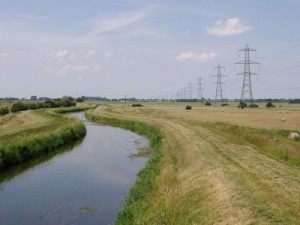
Water is an important Earth heritage resource which receives statutory protection through a range of laws and regulations[10]. These are administered by the Environment Agency (and national variants) through a Groundwater Protection Policy and the designation of Source Protection Zones which are monitored for pollution and contamination. Groundwater is managed by the Agency through Catchment Abstraction Management Strategies; surface water is managed under River Basin Management Plans and Catchment Flood Management Plans: all have important effects on the physical landscape and thus biodiversity.
Everyday geoconservation
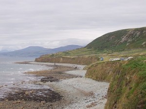
Protected landscapes such as AONBs and Heritage Coasts often have geodiversity features as core factors in their designation. Big landowning organisations such as the National Trust, the Wildlife Trusts and the RSPB are examples of conservation organisations which routinely protect geodiversity as part of their remit. Many countryside organisations and local conservation trusts also do the same. Landowners may conserve geodiversity as part of enhancement of landscape, habitat and historic features, e.g. through Environmental Stewardship in England or Rural Development Packages in Scotland. Habitat action plans may directly benefit geodiversity by conserving significant landform elements, for example coastal sand dunes, limestone pavements.
New approaches
While a site-based approach may draw conservation attention to a designated feature of interest, it implicitly treats features outside the designated area as having lesser importance. Given the policy direction of PPS9 towards conserving ‘geological interests in the wider environment’, there is a need for a more holistic approach. Faced with ongoing, diffuse threats to geodiversity, such as development pressures at a landscape level, the site-based approach may not be enough to protect geodiversity in the wider landscape. Geographic Information Systems (GIS) and vulnerability mapping techniques offer new possibilities for geoconservation. For example, the Landmap programme in Wales combines geodiversity, biodiversity, historical / archaeological, cultural, visual and sensory datasets to provide an integrated landscape planning tool[11]. Furthermore, new digital technologies have great potential for communicating geodiversity features to a wider public.
Footnotes
1 Planning Policy Statement 9 – Biodiversity and geological conservation (ODPM, 2005)
2 Scottish Planning Policy (Scottish Government, 2010) – see http://www.scotland.gov.uk/Publications/2010/02/03132605/0.
3 Landscape Character Areas (LCAs) and Landscape Description Units (LDUs) have been defined. Historic Landscape Characterisation has also been carried out, to map the landscape in terms of its historic origin.
4 Planning Policy Statement 7: Sustainable Development in Rural Areas (ODPM, 2004).; see sections 24 and 25.
5 The First Soil Action Plan for England: 2004-2006 (DEFRA, 2004)
6 See http://www.snh.gov.uk/land-and-sea/managing-the-land/soils/soil-framework/ .
7 The State of Soils in England and Wales (Environment Agency, 2004)
8 Safeguarding our Soils – A Strategy for England (DEFRA, 2009) – see http://www.defra.gov.uk/environment/quality/land/soil/documents/soil-strategy.pdf.
9 See http://ec.europa.eu/environment/soil/index_en.htm
10 Including the European Nitrates Directive 1991, the Groundwater Regulations 1998, the Water Framework Directive 2000, the Nitrate Pollution Prevention Regulations 2008.
11 See http://landmap.ccw.gov.uk/ .


